Niger Flag
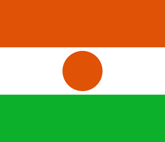
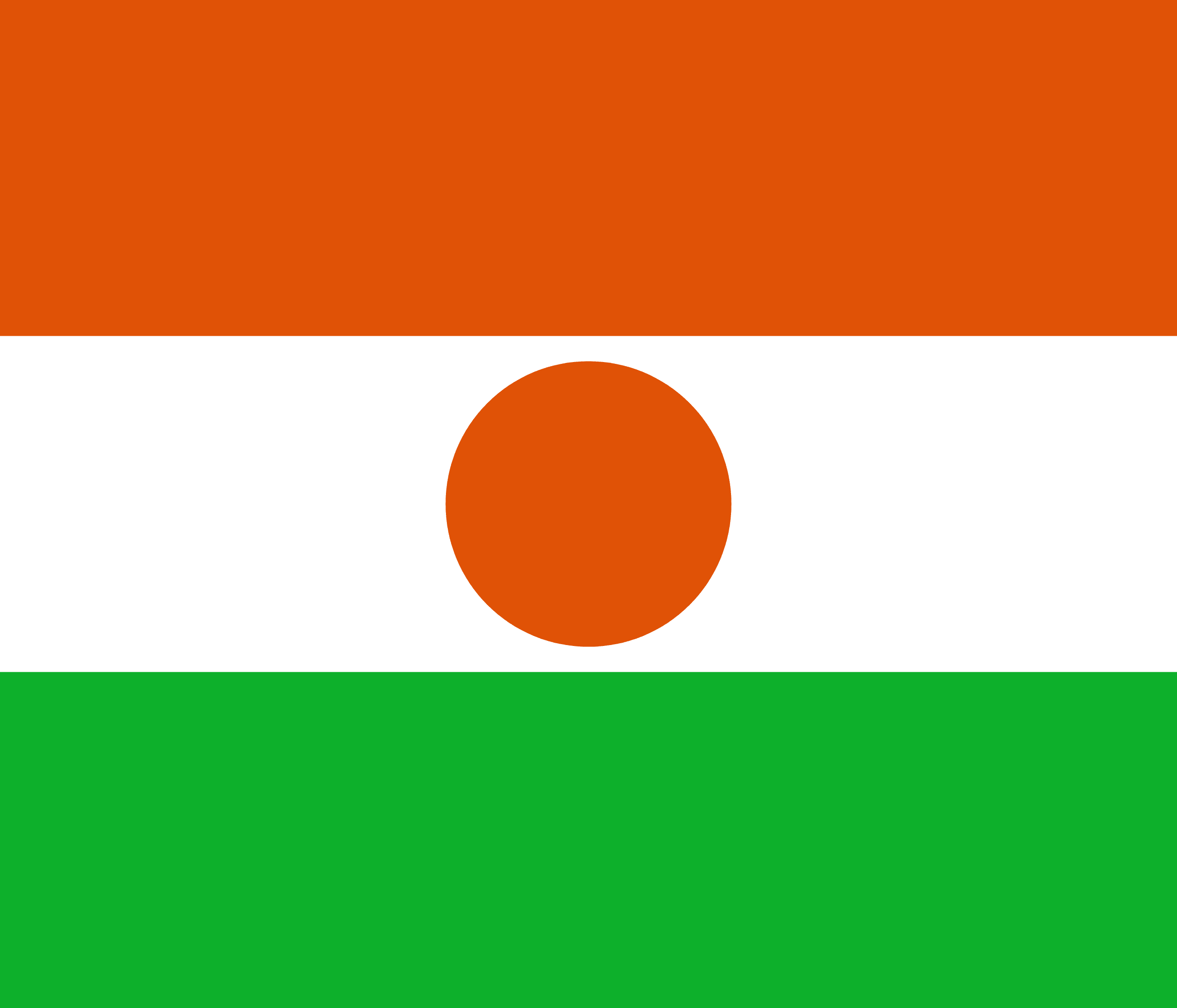
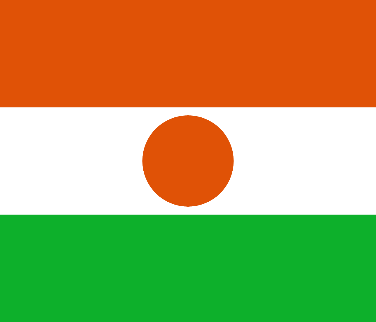
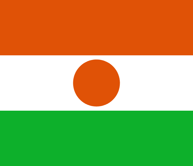
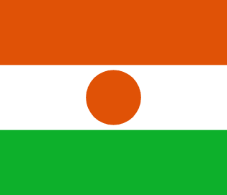
Niger's flag is the national flag of the Republic of Niger. Since 1959, a year before the country's formal independence from French West Africa, it has served as the national flag. The flag is made up of three equal horizontal stripes of orange, white, and green, with a central orange roundel.
Orange represents the desert, white represents calm and innocence, while green represents hope, fertility, and Niger's grasslands. The roundel in the center of the flag depicts the sun and the people's ambition to construct the nation. Along with the coat of arms, the national anthem (“la Nigérienne”), and the national slogan “Fraternité, Travail, Progrès,” the flag is one of Niger's recognized national symbols (Brotherhood, Work, Progress).
Niger flag downloads
- completely free for commercial and non-commercial use (public domain)
- based on vector file from Wikipedia Commons
- PNG or WebP format (lossless compression)
- Right click on the links (save link as)
| Width | Height | PNG | WebP |
|---|---|---|---|
| 20px | 17px | ~0.1 KB | ~0.1 KB |
| 40px | 34px | ~0.4 KB | ~0.1 KB |
| 80px | 69px | ~0.7 KB | ~0.1 KB |
| 160px | 137px | ~2.6 KB | ~0.6 KB |
| Width | Height | PNG | WebP |
|---|---|---|---|
| 16px | 12px | ~0.1 KB | ~0.1 KB |
| 40px | 30px | ~0.4 KB | ~0.1 KB |
| 80px | 60px | ~0.8 KB | ~0.1 KB |
| 128px | 96px | ~2.5 KB | ~0.6 KB |
- completely free for commercial and non-commercial use (public domain)
- based on vector file from Wikipedia Commons
- PNG, WebP (lossless compression) or JPEG format (100% quality)
- Right click on the links (save link as)
| Width | Height | PNG | WebP | JPEG |
|---|---|---|---|---|
| 2560px | 2194px | ~2.6 KB | ~0.6 KB | ~34.9 KB |
| 1280px | 1097px | ~0.7 KB | ~0.1 KB | ~13.0 KB |
| 640px | 549px | ~0.4 KB | ~0.1 KB | ~5.6 KB |
| 320px | 274px | ~0.2 KB | ~0.1 KB | ~2.8 KB |
| 160px | 137px | ~0.1 KB | ~0.1 KB | ~1.5 KB |
| 80px | 69px | ~0.1 KB | ~0.1 KB | ~0.9 KB |
| 40px | 34px | ~0.1 KB | ~0.1 KB | ~0.6 KB |
| 20px | 17px | ~0.1 KB | ~0.1 KB | ~0.4 KB |
- completely free for commercial and non-commercial use (public domain)
- based on vector file from Wikipedia Commons
- SVG, PDF (Adobe Acrobat), AI (Adobe Ilustrator) or EPS format
- Right click on the links (save link as)
| Format | SVG | AI | EPS | |
|---|---|---|---|---|
| Vector download | ~0.3 KB | ~12.5 KB | ~29.7 KB | ~1533.8 KB |
Country information
Niger is a landlocked country located in West Africa. It is bordered by Algeria and Libya to the north, Chad to the east, Nigeria and Benin to the south, and Burkina Faso and Mali to the west. Niger is a largely desert country, with a harsh and arid climate, but it is also home to a number of rivers and lakes, including the Niger River, which gives the country its name.
The history of Niger dates back to ancient times, with the first human settlements dating back to at least 2500 BC. The country has a diverse cultural heritage, with a mix of indigenous, Arab, and West African influences. Niger was colonized by the French in the late 19th century, and gained independence in 1960.
Today, Niger is a poor, developing country with a largely agricultural economy. The country is known for its production of oil, uranium, and other minerals, as well as its livestock and agricultural exports. Niger has a tropical desert climate, with hot and dry weather year-round. The official language of Niger is French, and the country has a diverse population with a mix of ethnicities and religions.
| Independent | Yes |
| Country codes | NE, NER (ISO 3166-1) |
| Official name | Republic of Niger |
| Official languages | French |
| Religion | 99.3% Islam, 0.3% Christianity, 0.2% Animism, 0.1% Irreligion |
| Capital city | Niamey |
| Continent | Africa |
| Time zone | UTC+1 (WAT) |
| Member of | United Nations |
| African Union | |
| Organisation of Islamic Cooperation | |
| Population | 26,463,741 (2023) |
| Population density | 19 per Km2 (49 people per mi2) |
| Urban Population | 16.5 % of the population is urban (4,002,638 people in 2020) |
| Migrants (net) | 4,000 |
| Median age | 15.2 years |
| Total area | The total land area is 1,266,700 Km2 (489,075 sq. miles) |
| Highest point | Mont Idoukal-n-Taghès (2 022 m, 6 634 ft) |
| Lowest point | Niger River (200 m, 656 ft) |
| GDP per capita | $ 590 (World Bank, 2021) |
| Currency | West African CFA franc (Fr, XOF) |
| Calling code | +227 |
| Internet TLD | .ne (click here to find and register domain name) |
| Country Wikipedia Page | Niger Wikipedia Page |
Main Cities by Population in Niger
| # | CITY NAME | POPULATION |
|---|---|---|
| 1 | Niamey | 774,235 |
| 2 | Zinder | 191,424 |
| 3 | Maradi | 163,487 |
| 4 | Agadez | 124,324 |
| 5 | Alaghsas | 88,561 |
| 6 | Tahoua | 80,425 |
| 7 | Dosso | 49,750 |
| 8 | Birni N Konni | 48,103 |
| 9 | Tessaoua | 35,775 |
| 10 | Gaya | 33,051 |
| 11 | Dogondoutchi | 31,767 |
| 12 | Diffa | 27,948 |
| 13 | Ayorou | 26,290 |
| 14 | Madaoua | 24,804 |
| 15 | Mayahi | 22,183 |
| 16 | Tera | 21,095 |
| 17 | Mirriah | 20,724 |
| 18 | Tibiri | 20,019 |
| 19 | Dakoro | 19,798 |
| 20 | Magaria | 19,419 |
| 21 | Tillaberi | 19,262 |
| 22 | Nguigmi | 17,897 |
| 23 | Matamey | 16,844 |
| 24 | Illela | 16,678 |
| 25 | Tanout | 15,204 |
