Lesotho Flag

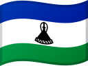
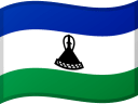
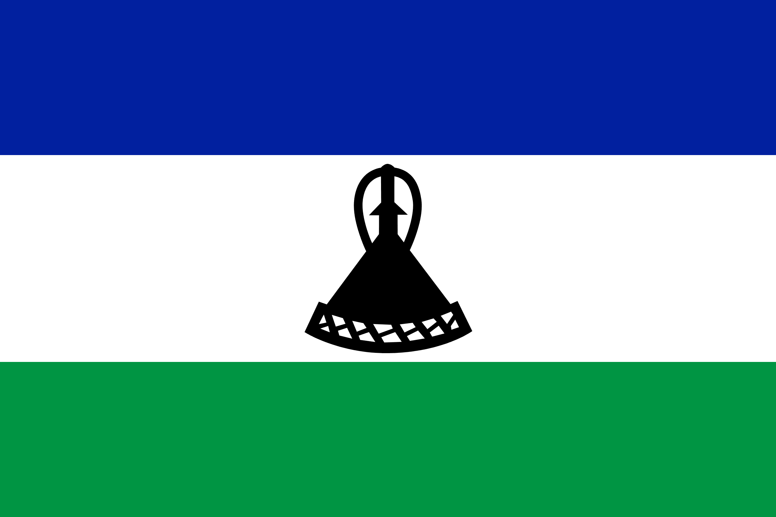
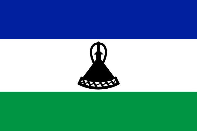
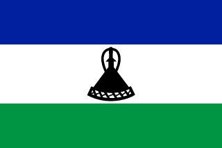
Lesotho's current national flag, which was adopted on October 4, 2006, is a tricolor consisting of horizontal blue, white, and green stripes. A black mokorotlo, a traditional Basotho cap, is in the center of the flag. The flag's design was designed to depict the country's peaceful nature, both internally and in its relationship with its only neighbor, South Africa.
Blue represents the sky and rain, white represents serenity, and green represents prosperity. The old design, which featured a military insignia of a shield, spear, and knobkerrie, was replaced by this one.
Lesotho flag downloads
- completely free for commercial and non-commercial use (public domain)
- based on vector file from Wikipedia Commons
- PNG or WebP format (lossless compression)
- Right click on the links (save link as)
| Width | Height | PNG | WebP |
|---|---|---|---|
| 20px | 13px | ~0.1 KB | ~0.1 KB |
| 40px | 27px | ~0.4 KB | ~0.1 KB |
| 80px | 53px | ~0.7 KB | ~0.1 KB |
| 160px | 107px | ~2.6 KB | ~0.6 KB |
| Width | Height | PNG | WebP |
|---|---|---|---|
| 16px | 12px | ~0.1 KB | ~0.1 KB |
| 40px | 30px | ~0.4 KB | ~0.1 KB |
| 80px | 60px | ~0.8 KB | ~0.1 KB |
| 128px | 96px | ~2.5 KB | ~0.6 KB |
- completely free for commercial and non-commercial use (public domain)
- based on vector file from Wikipedia Commons
- PNG, WebP (lossless compression) or JPEG format (100% quality)
- Right click on the links (save link as)
| Width | Height | PNG | WebP | JPEG |
|---|---|---|---|---|
| 2560px | 1707px | ~2.6 KB | ~0.6 KB | ~34.9 KB |
| 1280px | 853px | ~0.7 KB | ~0.1 KB | ~13.0 KB |
| 640px | 427px | ~0.4 KB | ~0.1 KB | ~5.6 KB |
| 320px | 213px | ~0.2 KB | ~0.1 KB | ~2.8 KB |
| 160px | 107px | ~0.1 KB | ~0.1 KB | ~1.5 KB |
| 80px | 53px | ~0.1 KB | ~0.1 KB | ~0.9 KB |
| 40px | 27px | ~0.1 KB | ~0.1 KB | ~0.6 KB |
| 20px | 13px | ~0.1 KB | ~0.1 KB | ~0.4 KB |
- completely free for commercial and non-commercial use (public domain)
- based on vector file from Wikipedia Commons
- SVG, PDF (Adobe Acrobat), AI (Adobe Ilustrator) or EPS format
- Right click on the links (save link as)
| Format | SVG | AI | EPS | |
|---|---|---|---|---|
| Vector download | ~0.3 KB | ~12.5 KB | ~29.7 KB | ~1533.8 KB |
Country information
Lesotho, officially the Kingdom of Lesotho, is a small, landlocked country in Southern Africa. It is completely surrounded by South Africa, with the exception of a small border with Mozambique. The country has a population of approximately 2.3 million people and is known for its mountainous terrain, which includes the highest peak in Southern Africa, the 3,482 meter high Thabana Ntlenyana.
The official language of Lesotho is Sesotho, a Bantu language, and the majority of the population are members of the Basotho ethnic group. The country has a rich cultural history, with traditional practices and customs still an important part of daily life for many people.
The economy of Lesotho is primarily based on agriculture and livestock, with livestock being the main export. The country is also home to a number of small-scale industries, including textiles, food processing, and construction.
Lesotho is a constitutional monarchy, with King Letsie III serving as the head of state. The government is divided into three branches: the executive, the legislative, and the judiciary. The country is a member of the African Union, the Southern African Development Community, and the United Nations.
Despite its small size, Lesotho has a rich history and a unique culture that makes it an interesting and diverse country to visit or learn about.
| Independent | Yes |
| Country codes | LS, LSO (ISO 3166-1) |
| Official name | Kingdom of Lesotho |
| Official languages | Sesotho and English |
| Religion | 92.3% Christianity, 6.4% Traditional faiths, 1.0% Others, 0.3% None |
| Capital city | Maseru |
| Continent | Africa |
| Time zone | UTC+2 (South African Standard Time) |
| Member of | United Nations |
| Commonwealth of Nations | |
| African Union | |
| Southern African Development Community | |
| Population | 2,185,694 (2023) |
| Population density | 71 per Km2 (183 people per mi2) |
| Urban Population | 31.5 % of the population is urban (674,092 people in 2020) |
| Migrants (net) | -10,047 |
| Median age | 24.0 years |
| Total area | The total land area is 30,360 Km2 (11,722 sq. miles) |
| Highest point | Thabana Ntlenyana (3 482 m, 11 424 ft) |
| Lowest point | Confluence of Orange River and Makhaleng River (1 400 m, 4 593 ft) |
| GDP per capita | $ 1,094 (World Bank, 2021) |
| Currency | Lesotho loti (L, LSL) |
| Calling code | +266 |
| Internet TLD | .ls (click here to find and register domain name) |
| Country Wikipedia Page | Lesotho Wikipedia Page |
Main Cities by Population in Lesotho
| # | CITY NAME | POPULATION |
|---|---|---|
| 1 | Maseru | 118,355 |
| 2 | Mafeteng | 57,059 |
| 3 | Leribe | 47,675 |
| 4 | Maputsoe | 32,117 |
| 5 | Mohale's Hoek | 28,310 |
| 6 | Qacha's Nek | 25,573 |
| 7 | Quthing | 24,130 |
| 8 | Butha-Buthe | 16,330 |
