Mayotte Flag
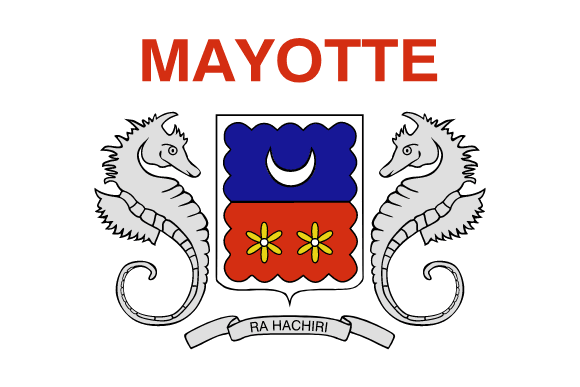
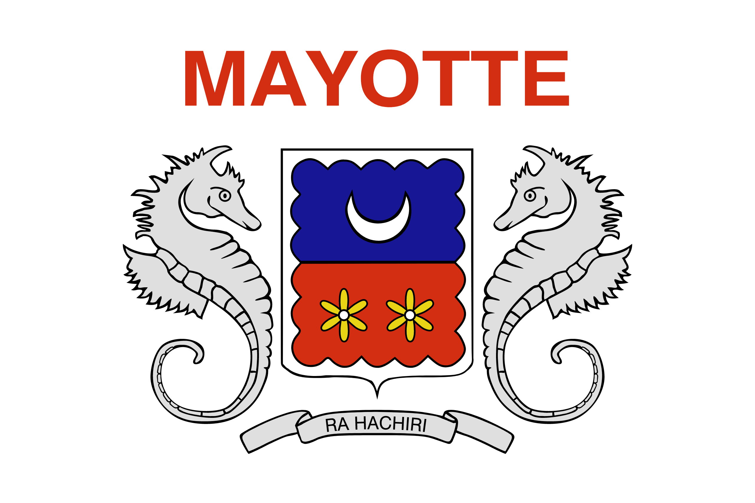
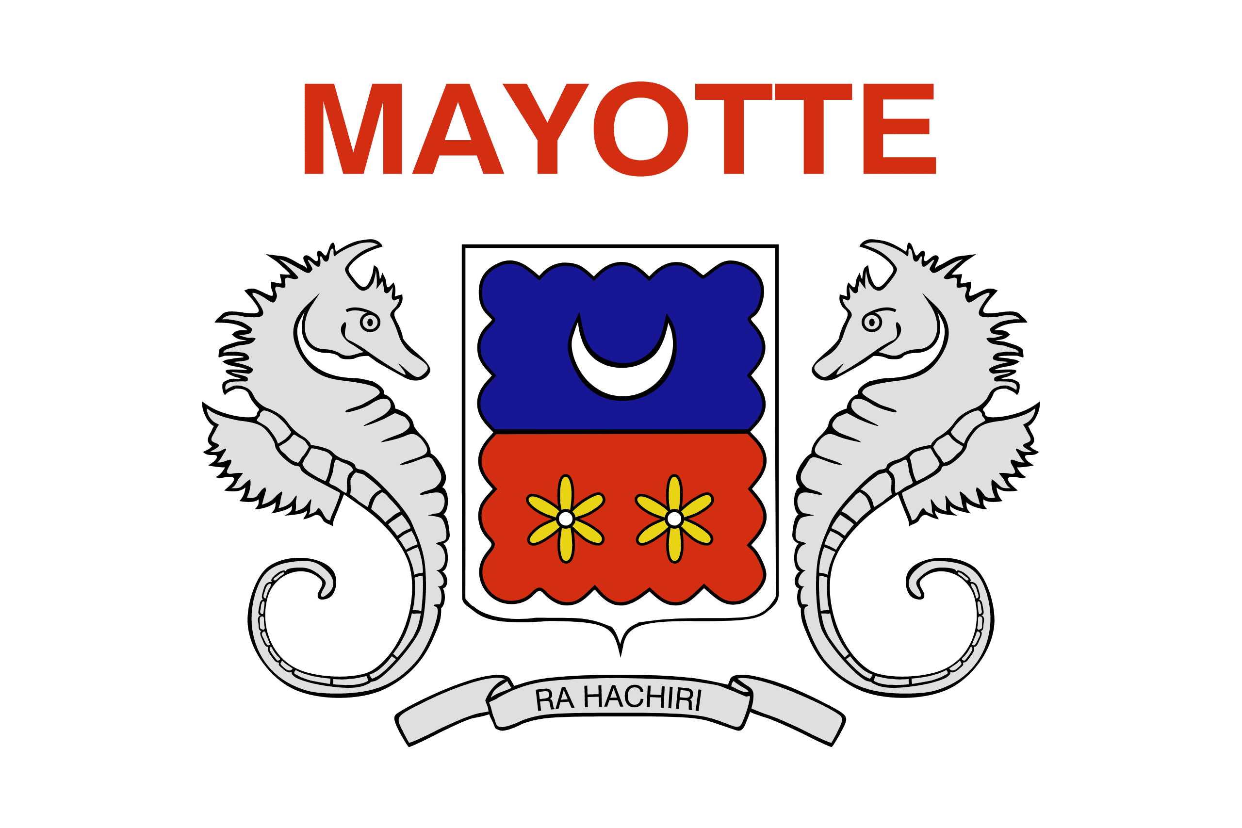
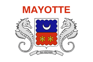
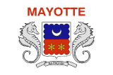
Mayotte's coat of arms was created by Michel Chabin, former director of the Reunion Archives, and illustrated by Pascale Santerre. On July 23, 1982, the old General Council of Mayotte adopted them, and the department of Mayotte officially adopted them in 2011.
The coat of arms' colors, blue and red, are taken from the French flag, with the addition of a yellow tint to represent the two ylang-ylang flowers. The ylang-ylang blooms are utilized as a symbol of the island's attractiveness.
Mayotte flag downloads
- completely free for commercial and non-commercial use (public domain)
- based on vector file from Wikipedia Commons
- PNG or WebP format (lossless compression)
- Right click on the links (save link as)
| Width | Height | PNG | WebP |
|---|---|---|---|
| 20px | 13px | ~0.1 KB | ~0.1 KB |
| 40px | 27px | ~0.4 KB | ~0.1 KB |
| 80px | 53px | ~0.7 KB | ~0.1 KB |
| 160px | 107px | ~2.6 KB | ~0.6 KB |
| Width | Height | PNG | WebP |
|---|---|---|---|
| 16px | 12px | ~0.1 KB | ~0.1 KB |
| 40px | 30px | ~0.4 KB | ~0.1 KB |
| 80px | 60px | ~0.8 KB | ~0.1 KB |
| 128px | 96px | ~2.5 KB | ~0.6 KB |
- completely free for commercial and non-commercial use (public domain)
- based on vector file from Wikipedia Commons
- PNG, WebP (lossless compression) or JPEG format (100% quality)
- Right click on the links (save link as)
| Width | Height | PNG | WebP | JPEG |
|---|---|---|---|---|
| 2560px | 1707px | ~2.6 KB | ~0.6 KB | ~34.9 KB |
| 1280px | 853px | ~0.7 KB | ~0.1 KB | ~13.0 KB |
| 640px | 427px | ~0.4 KB | ~0.1 KB | ~5.6 KB |
| 320px | 213px | ~0.2 KB | ~0.1 KB | ~2.8 KB |
| 160px | 107px | ~0.1 KB | ~0.1 KB | ~1.5 KB |
| 80px | 53px | ~0.1 KB | ~0.1 KB | ~0.9 KB |
| 40px | 27px | ~0.1 KB | ~0.1 KB | ~0.6 KB |
| 20px | 13px | ~0.1 KB | ~0.1 KB | ~0.4 KB |
- completely free for commercial and non-commercial use (public domain)
- based on vector file from Wikipedia Commons
- SVG, PDF (Adobe Acrobat), AI (Adobe Ilustrator) or EPS format
- Right click on the links (save link as)
| Format | SVG | AI | EPS | |
|---|---|---|---|---|
| Vector download | ~0.3 KB | ~12.5 KB | ~29.7 KB | ~1533.8 KB |
Country information
Mayotte is an overseas department and region of France located in the Indian Ocean. It is composed of the main island of Mayotte and several smaller islands, and is situated between the eastern coast of Africa and the northern tip of Madagascar. Mayotte has a population of about 270,000 people and its capital is Mamoudzou.
The island was originally inhabited by the Swahili people and was later colonized by the Portuguese and then the Comoros. It became a French possession in the late 19th century and was officially declared an overseas department of France in 2011.
Mayotte has a tropical climate with hot and humid weather year-round. The island is known for its beautiful beaches, crystal clear waters, and rich marine life, making it a popular tourist destination. The economy of Mayotte is largely based on agriculture, with crops such as vanilla, ylang-ylang, and coconut being important exports. The island is also home to a number of industries, including construction, fishing, and manufacturing.
The official language of Mayotte is French, although the local language, Shimaore, is also widely spoken. The population of Mayotte is predominantly Muslim, with a small Christian minority. The island has a diverse cultural heritage, with influences from African, Arab, and European cultures.
| Independent | No |
| Country codes | YT, MYT (ISO 3166-1) |
| Official name | Department of Mayotte |
| Official languages | French |
| Religion | / |
| Capital city | Mamoudzou |
| Continent | Africa |
| Time zone | UTC+03:00 (EAT) |
| Member of | / |
| Population | 289,687 (2023) |
| Population density | 728 per Km2 (1,884 people per mi2) |
| Urban Population | 45.8 % of the population is urban (124,952 people in 2020) |
| Migrants (net) | / |
| Median age | 20.1 years |
| Total area | The total land area is 375 Km2 (145 sq. miles) |
| Highest point | Benara on Mahoré (660 m, 2 165 ft) |
| Lowest point | Mozambique Channel |
| GDP per capita | $ / (World Bank, 2021) |
| Currency | Euro (€, EUR) |
| Calling code | +262 |
| Internet TLD | .yt (click here to find and register domain name) |
| Country Wikipedia Page | Mayotte Wikipedia Page |
Main Cities by Population in Mayotte
| # | CITY NAME | POPULATION |
|---|---|---|
| 1 | Mamoudzou | 54,831 |
| 2 | Koungou | 18,118 |
| 3 | Dzaoudzi | 15,339 |
